
Drain or Elevate: Tackling Standing Water on Sports Fields
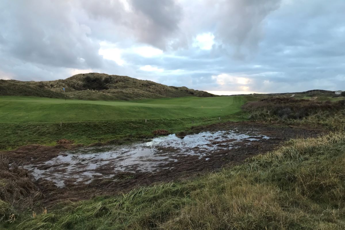
The Noordwijkse Golf Club (NGC) has been facing ponding water, forming puddles and ponds, on low-lying parts of the golf course for extended periods since 2023, particularly at holes 1, 2, 8, 9 and 10. This problem is caused by exceptionally high groundwater levels as a result of extreme rainfall in 2023 and 2024. On behalf of the NGC, Acacia Water conducted an analysis to investigate the causes and propose potential solutions.
In 2023 and 2024, the Noordwijkse Golf Club (NGC) experienced exceptionally high groundwater levels due to prolonged and intense rainfall. In 2023 alone, approximately 272,000 m³ of additional rainwater fell on the 68-hectare site, equivalent to nearly 100 Olympic-sized swimming pools, compared to a typical year.
Although the golf course is located in a dune area with sandy soils that offer good infiltration capacity, the lack of drainage infrastructure means that excess water is not discharged quickly. Pumping the water away is not a straightforward solution either: because the surrounding area also has elevated groundwater levels, any extracted water would be quickly replaced, making the volume to be pumped significantly larger and less manageable.
Possible causes of localized flooding
The analysis indicates that other potential causes, such as reduced crop evaporation due to tree removal, the reduction or cessation of groundwater abstractions on and around the site, sea level rise and changes in the ‘boezempeil’ (the controlled surface water level in the network of canals, ditches, and water bodies where excess water from polders is discharged), may influence groundwater levels at the NGC site, but are not, or only minimally, responsible for the standing water forming puddles and ponds on the golf course.
The primary cause appears to be the exceptional rainfall experienced in 2023. As a result, the soil’s water storage capacity remained saturated well into the summer of 2024. When above-average rainfall returned in September 2024, it quickly led (again) to ponding and localized flooding of the lower-lying areas of the course.
Although high groundwater levels like these have been historically rare at NGC, climate change may increase their frequency. Archival data confirms that in the past, localized flooding was infrequent and typically limited to small, short-lived puddles. The existing drainage infrastructure, such as the pond on hole 2 equipped with a drainage pump, is currently insufficient to effectively handle the excess water volumes.
A dynamic coastal setting
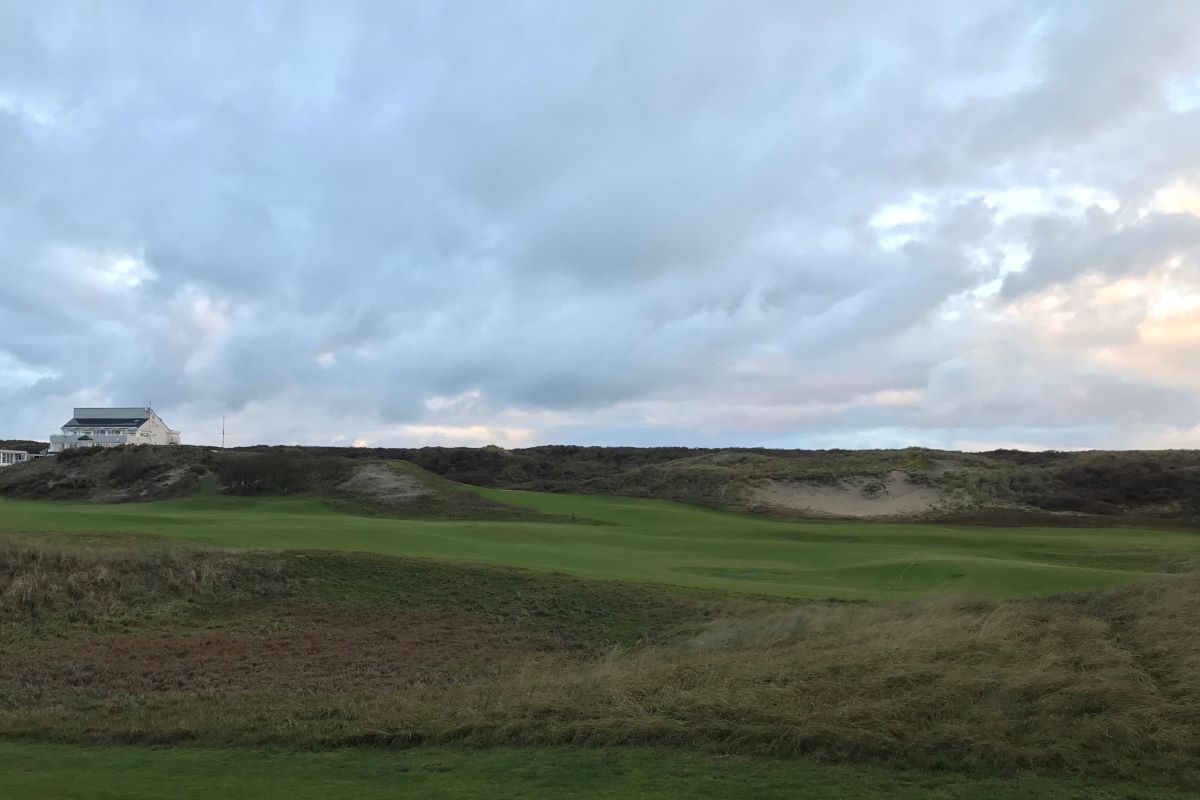
The Noordwijkse Golf Club (NGC) is located in the dune area north of Noordwijk in the Dutch province of South Holland. The 68-hectare site features a diverse landscape of dunes, valleys and open grasslands. It is a dynamic coastal area with elevations varying from approximately NAP +3.2 meters in the lowest dune valleys to over NAP +20 meters on the highest parabola dunes and the coastal dune ridge.
The underlying groundwater system is consists of a 40-60 meter thick freshwater lens floating atop deeper saline groundwater. This system is primarily influenced by natural hydrological processes including rainwater infiltration, evapotranspiration and groundwater discharge towards the North Sea and inland areas.
Towards a structural solution: elevating low-lying areas
Based on the findings, the most effective and long-term solution is to elevate low-lying areas of the golf course. This may be complemented by improvements to the existing drainage infrastructure, enabling more efficient discharge of excess water during future extreme rainfall events.
Acacia Water conducted a comprehensive analysis to determine the causes of localized flooding at the Noordwijk Golf Club (NGC) and identify possible solutions. The approach consisted of the following steps:
- Desk study and document review.
All available documentation on the groundwater system and water ponding at the NGC were reviewed, including historic data, internal golf club reports, stakeholder correspondence, and previous studies on water resources in the area. - Stakeholder Consultation.
Follow-up questions from the desk study were addressed through telephone and email communication with stakeholders, including the Noordwijkse Golf Club, Hoogheemraadschap van Rijnland, and Waternet. - Data analysis and historical comparison.
A comprehensive analysis of:- Rainfall data from nearby KNMI weather stations (Lisse, Zandvoort and Katwijk aan den Rijn).
- Groundwater levels at the golf course (NGC) and surrounding dune areas (measurements from Waternet).
- Surface water levels in the region (data from Hoogheemraadschap van Rijnland).
- Irrigation water use of the NGC, to assess thge impact of changes in groundwater abstraction.
- Site visit and field measurements.
In early December 2024, the golf course was visited to assess landscape conditions and drainage features. In mid-December, eight monitoring wells were measured were surveyed to determine precise ground elevations and groundwater levels relative to NAP.
The data analyses showed that 2023 and 2024 were exceptionally wet years, leading to significantly elevated groundwater levels at the NGC site and the surrounding dune area. This is the primary cause of the localized flooding observed on the golf course.
Acacia Water concluded that raising the elevation of low-lying areas is the most effective and sustainable solution to mitigate standing water, forming puddles and ponds, on low-lying parts of the golf course in the future.
With climate change likely to increase the frequency and duration of extreme rainfall events, a structural adaptation of the golf course is necessary to protect it from long-term waterlogging and maintain playability year-round.
